Walking the Cove to Lake Trail, by Yasuko Smith
I was looking for a great family challenge for my children (four, eight, and nine years old), and we decided on the Cove to Lake Trail in La Quinta. Right from the start of the trail, the mottled pattern of the rocks on the sides of the mountains caught our eyes. These are the dark colorings of deep time, known as “desert varnish”.
Photo by Yasuko Smith
Desert varnish occurs where there are significant differences in day and night temperature. Rocks rich in oxides of manganese and iron, coupled with bacteria and hydration from night time moisture in the air, leaches out miniscule amounts of minerals from the rock surface. During the daytime, the moisture evaporates, redepositing the mineral as a surface stain. Over time, the minerals accumulate and the rock surface gradually darkens. It can take centuries for well developed desert varnish to form, mainly on upland surfaces and the sides of mountains that are not subjected to disturbance. The trail is in the Santa Rosa Mountains, which are strongly defined by the San Jacinto fault zone, uplifted in huge monolithic blocks during the late Cenozoic period, roughly 66 million years ago. The alluvial fans at the lower slopes of the Santa Rosa Mountains are always a beautiful sight, and not only from a geological perspective. Starting off from the trailhead, we noted that the small valley at the start of the trail was filled with cheesebush, Ambrosia salsola, which derives its name from its parmesan-like smell. We rubbed a leaf between our fingers to release the odor to test the theory. We all agreed that the cheese it was compared to must be one of those fancy stinky cheeses.
Photo by Yasuko Smith
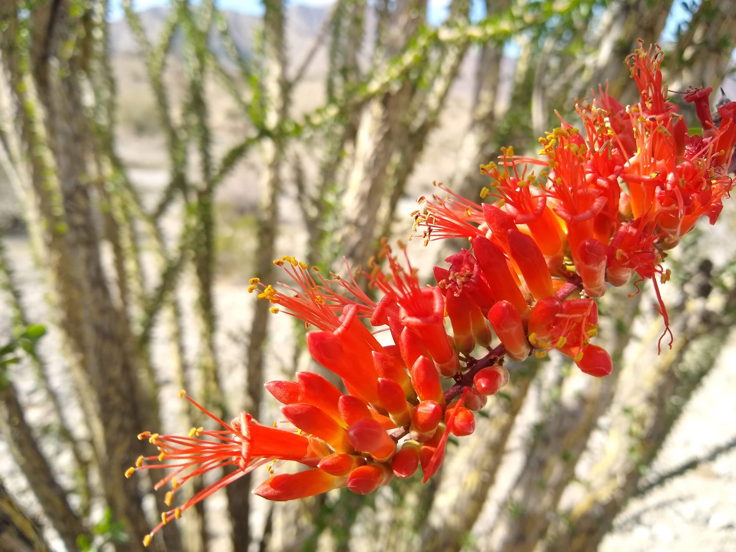
Continuing on the trail, the fallen tree trunks make for a good spot to sit and appreciate plants like creosote bush, another aromatic and successful desert shrub, as well as chuparosa and the ambiance of the Santa Rosa Mountains. The trail gradually climbs to the high point, passing beautiful ocotillo, Fouquieria splendens, with its bright red-orange blooms that are prolific after rain and cholla, and silver cholla, Cylindropuntia echinocarpa, with its uninviting spines. We also saw blooming forget-me-nots, Cryptantha sp., in hues of blue and white, on boths sides of the trail. Once we reached the high point, roughly the midway point of the trail, my kids noticed several holes in the hills and we began to brainstorm which animals could have made them. Could have it been snakes, bats, or maybe bears? There were so many holes, it was exciting to guess which desert animal would have the ability to create so many of them. Turns out it was no animal at all, but water! When it rains, water in the desert becomes a major agent of erosion, carving pathways in the walls of the valley. This eats away the concretious matrix around rocks and boulders, until eventually they tumble down, leaving a network of holes that are often mistaken for animal burrows.
Photo by Yasuko Smith
Once upon a time, we would have been standing on the shores of a large prehistoric lake called Lake Leconte. For millions of years the Colorado River was the source of water for the lake, but over time, earthquakes and subsequent large fault movements created a natural barrier that shut off the river’s flow. At its peak, the freshwater lake covered over 2,000 square miles, to a depth of more than 300 feet at its deepest points. After the river was shut off from the lake, it would periodically dry up and refill when floods broke through the thick accumulation of sediment buildup from river silt deposits from the muddy waters of the Colorado River, forming ancient Lake Cahuilla.
From our viewpoint, we could see the shores of the Salton Sea, formed in essentially the same manner as the ancient lake. Where the shores once bordered the bedrock of the mountain slopes, it left a white encrustation, called travertine. Travertine, or tufa, is a freshwater lime deposit, derived from waters that has a high concentration of calcium carbonate, CaCO3, the material from shells of mollusks and other aquatic animals. The light color travertine is a stark contrast to the reddish brown desert varnish, creating highly visible shorelines when the lake dried out that can be seen for miles along the base of the Santa Rosa Mountains, from La Quinta for several miles southeast along the shore of the present Salton Sea. Sediment along the hills still boasts prehistoric seashells, remnants of the lake that once dominated this land. After your hike, take a drive along HWY 86, where the old shoreline is still evident near Desert Shores.
Photo by Yasuko Smith
As we continued our journey, the mountains were a reminder of the geological power needed to uplift gigantic fault blocks, generated by movement from the Pacific and the North American tectonic plates grinding past one another. Minor faults associated along with the infamous San Andreas fault, essentially divide the Coachella Valley. Depending on the nature and magnitude of the fault movement that created it, each block has its own distinctive landscape evolution, creating pockets of unique biodiversity throughout the valley. The trail ends at Lake Cahuilla, a man-made reservoir located at the end of the 122-mile Coachella Canal, the aqueduct which directs the water from the Colorado River - the modern equivalent of the process that filled the ancient lake! It is managed by the Riverside County Regional Parks, Lake Cahuilla Veterans Regional Park is now home to fishing, camping, and bird-watching enthusiasts. There is also a play area by the lake which was thoroughly enjoyed by my children who braved this trail with me. For a small fee, you can park your car here and make a day of it. Otherwise you can enjoy your lunch by the lake, then head back to the trailhead.
Try out the La Quinta Cove to Lake Trail next time you want an enjoyable outing - just be sure to take plenty of water, (because it’s still the desert), stay on the path to ensure minimal impact and enjoy nature, the geology, and ecology of the Coachella Valley. Happy trails!


